Minyon Falls
Minyon Falls plunges a depth of around 97-104m into a deep palm-shaded gorge below. Everyone has an opinion on how high the falls are - all we really know for sure - it's a long way down.
You can drive to the top of these beautiful falls and admire them from above and look down into the rain forest below. The tops of the cliffs are forested with Blackbutt and Scribbly Gum - very australian bush.
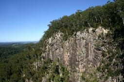
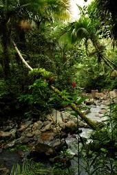
You can follow the rainforest trail to the bottom of the falls, walking through subtropical Booyong Rainforest and Brush Box which occupies the gully beneath. The change of vegetation as you wander down is very obvious with the gorge having it's own microclimate which is dramatically different to the rest of the area.
Follow the signs for the footpath from the top of the falls. There are actually 2 walks you can do. The second one takes you around to Quandong Falls and is called the Minyon Loop.
This path takes in a lookout over the Falls and follows the rim of the escarpment and takes you to Quandong Falls - named after a local rainforest tree.
There is a pool at the foot of Minyon Falls where you can swim. You will feel like you are a million miles from anywhere here.
The walks are quite easy going down - a bit tougher on the way back up.
At certain times of the day and in winter especially the valley can have pockets of mist and with the vegetation it gives it all a very 'Jurassic Park' feel. You half expect to see a T-Rex at any second. It's magical.
Toilets and picnic/barbecue facilities are provided at the top of the falls where you get a view of the ocean in the far distance on clear days.
The walk down to the base of the falls and back is a 4 km round trip and can take up to 2 hours.
The Minyon Loop is 7.5 km and takes 4.5 hours.
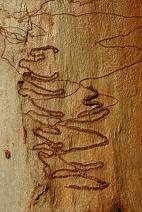
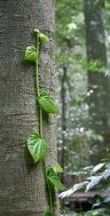
Rain Forest Trees line the path further down - and up top are Scribbly Gums (opposite)
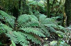 The foot of the gorge is incredibly lush and tropical in feel - such a contrast to the top.
If you are visiting during a dry spell the fall will likely not have much of a flow as it does tend to dry up fairly quickly after a few weeks with no rain, even after heavy rain it can seem small compared to some of the worlds better known falls - so don't be expecting Niagara or Angel Falls as you will be sorely disappointed.
The falls belong to the larger area known as Minyon Falls Flora Reserve. The area has high scientific, recreational and scenic value and so is excluded from all logging operations.
The falls are located in the Nightcap National Park.
If you continue on and follow the main forest drive turning right at Peates Mountain Road. After 200m you will come to Rummery Park.
This grassy clearing is set amidst regrowth forest where koalas live. You may be lucky enough to see one.
There are picnic and camping facilities here. There is a relatively easy 3km walking track leading to Peates Mountain Lookout. The Boggy Creek Track (2 km) and Eastern Boundary Track (2.5 km) both lead you back to the Minyon Falls Picnic Area.
You can have a look at this national park and others in NSW at
www.nationalparks.nsw.gov.au
To get to the falls from Byron Bay head out through Goonengerry andafter about 8 km there is a right-hand-turn turn, signposted for Minyon Falls.
After four more kilometres there is another signposted turnoff on the right, into Minyon Drive - you really do need a map of the local area
map of the area
Leave Minyon Falls and head back to the Byron Bay Hinterland page
Leave Minyon Falls and head back to the Byron Bay Beaches Homepage
![]()


